
Buffalo River AOC Boundary Map
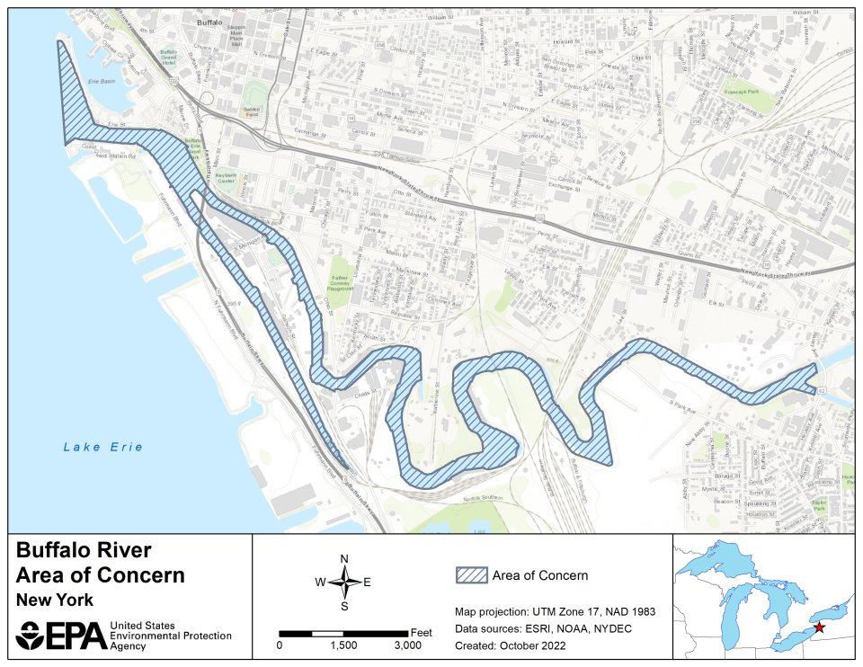
The Buffalo River AOC extends along the historically industrialized portion of the river, beginning at the mouth of the River and continuing approximately 6 miles upstream to the Bailey Avenue Bridge. It also contains the entire 1.4-mile City Ship Canal, located adjacent to the river. A large extent of the Buffalo River and City Ship Canal within the AOC boundary is designated as a federal navigation channel, which is maintained and routinely dredged by the U.S. Army Corps of Engineers (USACE) to a depth of 22 to 23 feet below low water datum.
The following files are available for download: