
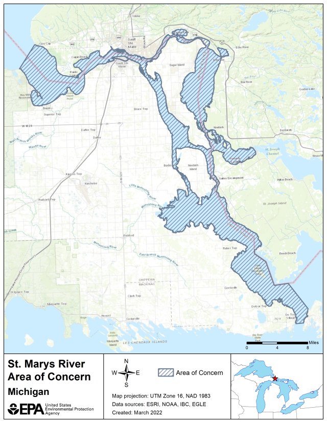
St. Marys River AOC Boundary Map
The following files are available for download for the St. Marys River AOC:
St. Marys River AOC Shapefile (zip)
St. Marys River AOC Boundary Map (kmz)
Official websites use .gov
A .gov website belongs to an official government organization in the United States.
Secure .gov websites use HTTPS
A lock () or https:// means you’ve safely connected to the .gov website. Share sensitive information only on official, secure websites.
The following files are available for download for the St. Marys River AOC:
St. Marys River AOC Shapefile (zip)
St. Marys River AOC Boundary Map (kmz)